Heritage A Universe of Heritage, Archaeological and Industrial Legacy
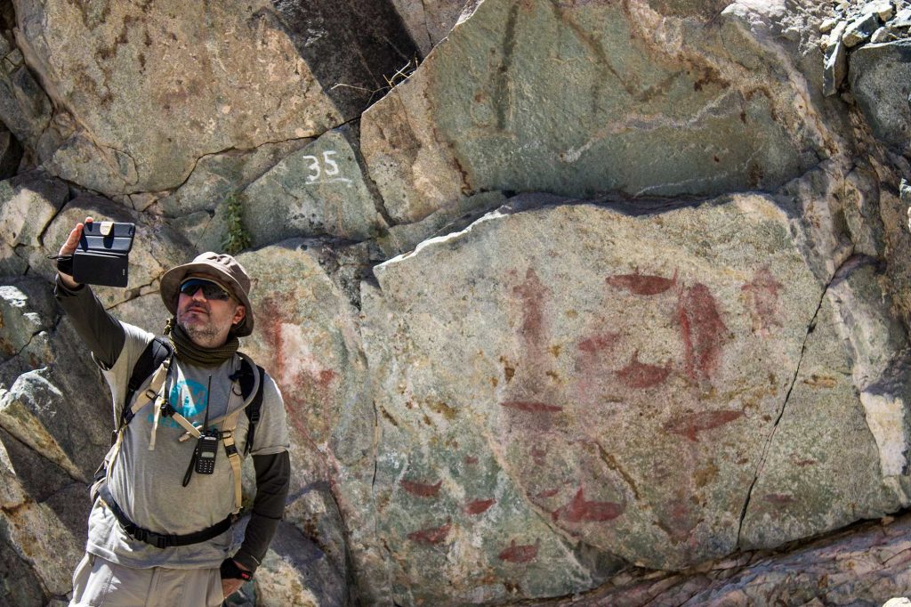
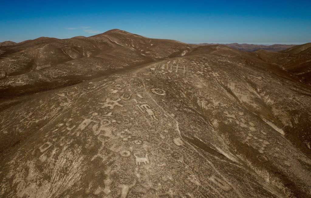
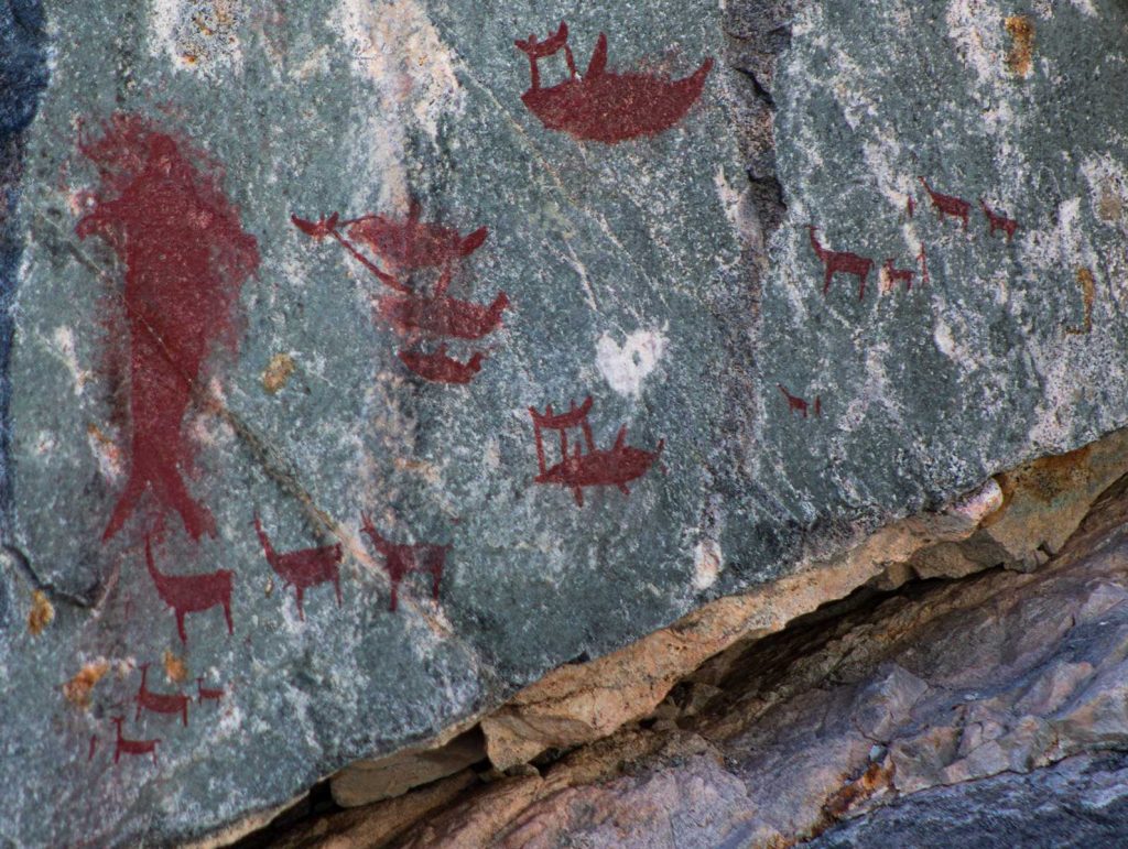
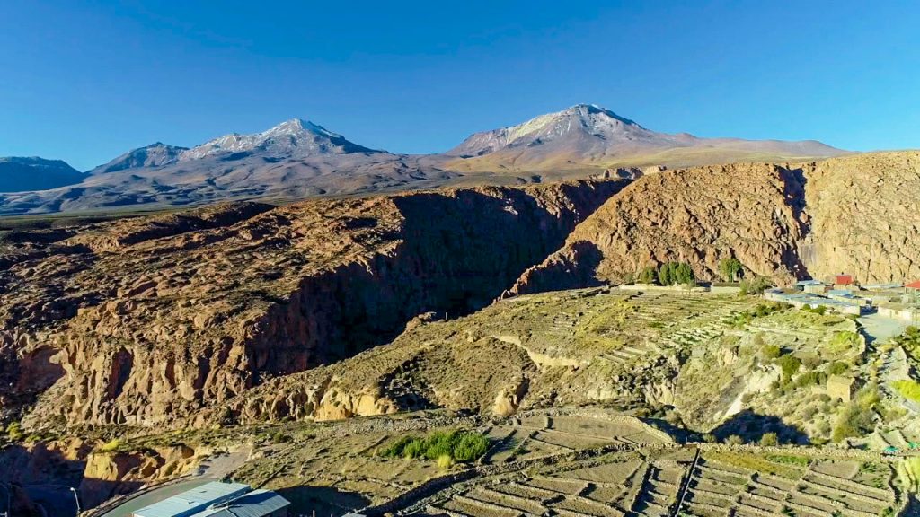
The Antofagasta Region has an invaluable heritage legacy both from its coasts with the culture of the Changos ethnic group and in the pampas and the highlands with a strong culture rooted in the Quechua, Aymara and Likanantay cultures. In its valleys coexist rivers, and hills engraved with petroglyphs that date back thousands of years as is the case of Lasana, Taira among others.
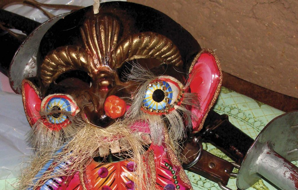
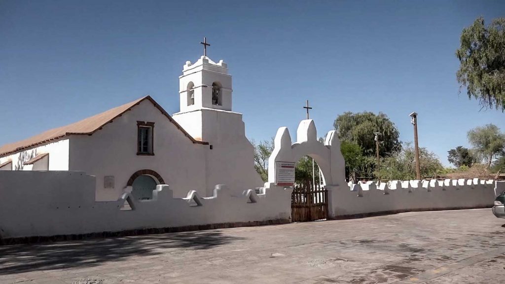
Heritage living also in its textile artisans, potters who currently maintain ancestral techniques, and religious festivals such as the Virgin of Guadalupe de Ayquina that is celebrated every September with thousands of faithful and visitors in a parade of colors, music and devotion.
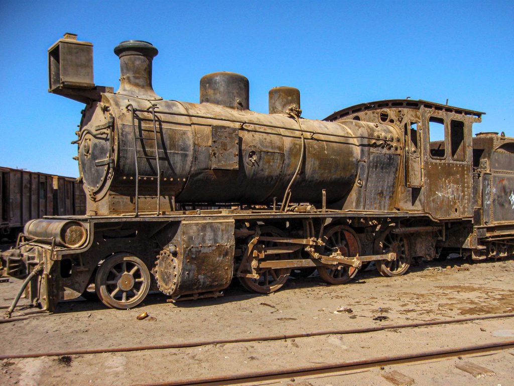
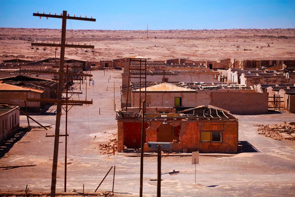
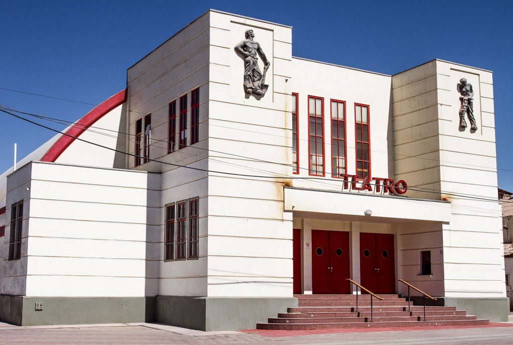
Places like the last saltpeter in the world, María Elena, which is active to this day and its historic center practically intact under the burning sun of the pampas. Also close to this commune is the Chug Chug Geoglyphs Archaeological Park, with a great archaeological wealth and caravan routes that have crossed it since pre-Hispanic times.
What to do
- Antofagasta
- Sierra Gorda - Baquedano
- María Elena
- Taltal
- Calama - Alto Loa
- San Pedro de Atacama
La Portada
La Portada natural monument, which belongs to the 15 natural monuments included within the protected wild areas of Chile, stands out for being a natural arch of marine rocks, of fossiliferous origin in the sea.
Location: 18 kilometers north of the city on Route 1.
Antofagasta airport time distance: 34 minutes
Historic Pier
Melbourne Clark Pier, mostly known as Historic Pier, is a pier that formerly received smaller vessels, located in the Historic Quarter of Antofagasta, part of the city’s historic center.
Location: Av. Balmaceda, Antofagasta
Distance kms from Antofagasta airport: 25.7 kilometers by Route 1
Antofagasta airport time distance: 29 minutes
Huanchaca Ruins
National Historic Monument, which is part of the remains of an old silver foundry, founded in 1873, under the name of Empresa Huanchaca de Bolivia, which currently has the creation of the Huanchaca Cultural Park, composed of the Museum of the Atacama Desert.
Location: Av. Angamos 01606, Antofagasta
Distance kms from Antofagasta airport: 30.8 kilometers by Route 1
Antofagasta airport time distance: 37 minutes
Desert Hand
Sculpture that is part of the Antofagasta region, built by the Chilean sculptor Mario Irarrázabal, based on reinforced concrete, made by contributions from the Pro Antofagasta Corporation, which until now is in charge of its maintenance.
Location: 75 kilometers south of Antofagasta
Distance kms from Antofagasta airport: 97.0 kilometers along Longitudinal North, Sector: Portezuelo Las Bombas – Quillagua / Panamericana Norte / Route 5 and Route 1
Antofagasta airport time distance: 1 hour, 23 minutes.
Former Baquedano Station
Former Baquedano Railway Station declared a Historical Monument, for being a testimony of the social and economic events of the region, where at present the Baquedano Railway Historical Park was built, with a museum that exposes the rise of this station in its epoch.
Location: Sierra Gorda, Antofagasta
Distance kms from Antofagasta airport: 166.2 kilometers by Route 25 and Panamericana Norte / Route 5
Time distance from Antofagasta Airport: 1 hour, 48 minutes
Former Saltpeter Office Chacabuco
Former Saltpeter Office declared a National Monument, a place with a state-of-the-art production system for the time, which came to have a population that exceeded five thousand inhabitants, which currently has a Heritage Route, where you can travel the entire General Plan of the Former Chacabuco Saltpeter Office.
Location: Sierra Gorda, Antofagasta.
Distance from Antofagasta airport: 124.0 kilometers by Panamericana Norte / Route 5 and B-400
Time distance from Antofagasta Airport: 1 hour, 22 minutes
María Elena City
María Elena is a commune in the Antofagasta Region, an old nitrate office with vast history, where you can visit Historical Monuments and museums with content of the epoch, such as the Museum of Remembrance, the Pampino Toy Museum and the Museum of the Salitre de María Elena.
Location: María Elena, Antofagasta
Distance kms from Antofagasta airport: 222.4 kilometers by Panamericana Norte / Route 5
Time distance from Antofagasta Airport: 2 hours, 34 minutes
Chug Chug Geoglyphes Park
Archaeological Park located in the Antofagasta Region, which constitutes the second archaeological area with the highest number of ancestral representations, through a park that has 15 thousand hectares, with a distribution of more than 500 geoglyphs, on the 30 meters raised on the slopes of the hills to be seen from the old caravan routes.
Location: María Elena, Antofagasta
Distance kms from Antofagasta airport: 222.4 kilometers by Panamericana Norte / Route 5
Time distance from Antofagasta Airport: 2 hours, 34 minutes
Médano Ravine
Historical site near the commune of Taltal, which has pictographic representations, stone paintings, dating back a thousand years ago and which formerly corresponded to an indigenous sanctuary of high scientific significance.
Location: 90 kilometers north of Taltal
Distance kms from Antofagasta airport: 244.9 kilometers along Longitudinal Norte, Sector: Portezuelo Las Bombas – Quillagua / Panamericana Norte / Route 5
Time distance from Antofagasta Airport: 2 hours, 58 minutes
Olive Tree Route
Oasis located in the commune of Taltal, which has the Los Olivos plot, where you can visit the whole variety of olive trees found in the commune, review the process of reception, grinding, tasting of processed oil and visit the oil mill, which is the olive oil factory.
Location: 10 minutes from Taltal
Distance kms from Antofagasta airport: 244.9 kilometers along Longitudinal Norte, Sector: Portezuelo Las Bombas – Quillagua / Panamericana Norte / Route 5
Time distance from Antofagasta Airport: 2 hours, 58 minutes
Chuquicamata
Chuquicamata Division, which is currently an open-pit copper and gold mine, located in the Antofagasta Region, considered the largest in the world and which until 2007 had a mining camp or town of the same name to shelter workers and their families.
Location: Chuquicamata, Calama, Antofagasta
Distance kms from Calama airport: 24.5 kilometers by Route 24 and Av Circunvalación / Route 25
Time distance from Calama Airport: 26 minutes
INDIGENOUS VILLAGES
Calama, capital of the province of El Loa, part of the Antofagasta region, has a wide range of indigenous people in the area, representing the Quechua and Atacameño communities, such as the people of Chiu Chiu, Caspana, Toconce, Ayquina and the Pukara de Lasana, with a vast historical trajectory for the indigenous culture of the area.
Church
Iglesia de San Pedro, also known as the Iglesia de San Pedro de Atacama, is located next to the Plaza de San Pedro de Atacama, being a National Monument of Chile and a favorite tourist destination.
Location: 88.9 kilometers from Calama
Time distance from Calama airport: 1 hour, 9 minutes
TULOR VILLAGE
Aldea de Tulor is an archaeological site, located near San Pedro de Atacama, being one of the oldest archaeological sites in northern Chile; situated between the Cordillera de la Sal and the sand dunes, with a village made up of various circular structures interconnected with each other and possessing different functions in relation to the activities that were carried out within them at that time.
Location: Aldea de Tulor is located 7.7 km southwest of San Pedro de Atacama
Distance in kms from Calama airport: 106.9 kilometers by Route 23
Time distance from Calama Airport: 1 hour, 17 minutes
Valley of the Moon
Tourist attraction, with geological formations, made up of transversal valleys and elevated outcrops, which with their colors resemble the reddish color of the moon, where you can also practice various sports activities, such as cycling and horseback riding, among others.
Location: 13 kilometers west of San Pedro de Atacama.
Time distance from Calama airport: 1 hour, 12 minutes
Pukará de Quitor
Atacama village built in the 12th century located on the southern slope of the Cordillera de la Sal, a ravine located next to the Rio Grande, being a fortress that is made up of walls organized in the form of circular or square terraces from which a panoramic view is reached of the valley, declared a National Monument in 1982.
Location: 2 kilometers from San Pedro de Atacama
Distance kms from Calama airport: 100.5 kilometers by Route 23
Time distance from Calama Airport: 1 hour, 15 minutes
Miscanti y Miñiques Lagoons
Altiplanic lagoons that are part of the Los Flamencos National Reserve, more than 4 thousand meters above sea level, where their water origins underground and at the foot of two volcanoes, becoming a reproductive area for birds such as the Tagua Cornuda, Pato Juarjual and Chilean Flamenco.
Location: Los Flamencos National Reserve
Distance kms from Calama airport: 216 kilometers by Route 23
Time distance from Calama Airport: 2 hours, 44 minutes
What Else to Do
Astrotourism
Adventure and Nature
A Universe of Adventure and Nature in the Atacama Desert, The Andes Highlands and the Pacific Coast
Heritage
Ethnotourism
Gastronomy
Sun and Beach
Urban
Urban
A Universe of Opportunities for Incentives, Meetings and Business, Entertainment and Urban Shopping